728*90

Monday, June 22, 2009

Learning the Loops: Kasota Prairie/St. Peter


Note: This is Part 2 of a four-part series on the bike loops listed in the Greater Mankato Visitors Bureau's biking/hiking trails map
Distance: 34 miles, though the distance increases if you decide to explore areas of St. Peter or forget to take a key left turn (the latter of which happened to me).
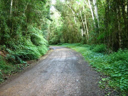
Directions: I began the loop by hopping on the Minnesota River Trail at the Main Street entrance downtown and heading north. When the trail intersects with 3rd Ave, take a left and continue heading north. After about three or four miles, the road curves to the left and turns into 355th Ave. Continue on that road until you get to Kasota, where you take a right on Hill Street and a left two blocks later onto Rabbit Road.
Continue north on Rabbit Road until it ends on Highway 99. Take a left onto Highway 99 and follow it through St. Peter. Once out of St. Peter, the road turns into County Road 5. About a mile or so past the Swanson's Tennis Center/Linneaus Arboretum area of town, take a left onto County Road 40 and follow that until the T intersection with Highway 99, where you then take a right. About 3 miles down the road, take a left onto County Road 13 and follow that back into North Mankato, where it becomes Lookout Drive.
Once in North Mankato, you have a couple of options. The trail map directs you to bike north on Lake Street, take a right on Lind Street, follow that across Highway 169 and head south on the Minnesota River Trail until you reach the Veterans Memorial Bridge, when you then take a left back into Mankato. However, if you're tired from the ride and want to end it quickly, turn onto Lee Blvd. off of Lookout Drive, hang a right onto Belgrade Ave, take another right onto Sherman Street, and then follow the sidewalk as it leads to the Highway 169 bridge and takes you back into Mankato near the YMCA and Burger King on Riverfront.
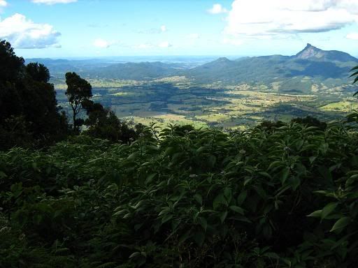
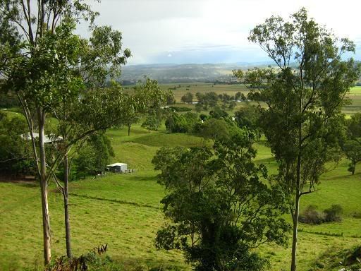
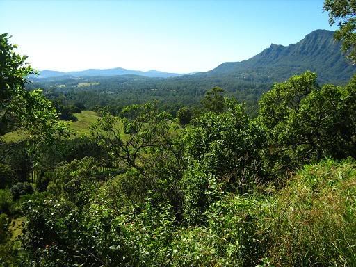
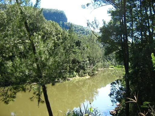
Notes on the route: It might be the second-longest of the four loops, but the KasotaPrairie/St. Peter ride might also feature the least amount of hills. Aside from having to climb up a small hill in St. Peter, there's no real inclines that stick out and the biggest elevation change on the whole ride is the wonderful downhill on Lookout Drive once you get into North Mankato (I recommend stopping at the lookout point and taking in the view, you can see almost all of Mankato). Because the first half the ride is still in the river valley, you also don't need to deal with as much wind as the other rides.
Safety-wise, I've always been a little skittish about riding on highway roads in the country. They're deceptively busy, they usually don't have much of a shoulder and cars that drive on them feel the need to go 65+ miles an hour without taking cyclists into account. That being said, Highway 99 west of St. Peter was surprisingly safel. It had a generous shoulder and motorists kept their respective distance.
Having to cross Highway 169 in St. Peter was no fun, but aside from that, there weren't many problematic intersections. The biggest safety concern of the whole ride is likely the lengthy downhill stretch of Lookout Drive. It's a busy road and it's also very steep, so I wouldn't recommend trying to set some sort of speed record on the way down.
The other memorable thing to note about the loop is the left-hand turn onto County Road 40 that I missed. This resulted in an extra 6 miles of riding on rolling country roads. I don't mind extra miles, but I do mind getting lost on roads with nothing but farm land for scenery.
Places to eat along the route: With all respect to the Prairie Saloon in Kasota, this ride is all about showcasing the main drag of St. Peter. And for a modestly-sized town along Highway 169, it doesn't disappoint.
Probably the most well-known sit-down restaurant on the route is the Whiskey River, which is located right off of Highway 99 before you cross the Minnesota River. According to locals, the meals there are a little pricey (their website also indicates that as well), but the food is considered excellent and venue offers a scenic view of the river. If you're looking to save a few dollars on a meal, look at their website and click on the "Newsletters" tab ahead of time. They have monthly coupons you can print out and use.
The place I stopped to eat at was the River Rock Cafe, which is located a couple blocks to the left on Highway 169 once you get into St. Peter. EXCELLENT atmosphere, friendly waitstaff and surprising amount of food options for a venue known for its coffee. If you need something to read while you're there, they also have a decent library of donated books and magazines to browse. Based on a quick look at previous Free Press editions, if you time your trip right, you might also hear some live music there from time to time.
I wish I could confirm how tasty their lunchtime sandwiches were, but since money was tight that, my cafe patronage was limited to a strawberry scone and a hot cup of green tea (not a coffee drinker, sorry). They also could not have been friendlier when I asked to fill my water bottle up for the ride home.
According to an April article in the Free Press, River Rock also scores high points for its reliance on local farmers for meat and other products. The cafe also has a plot in Kasota where it grows most of its own produce. Very cool to see a local cafe keep all of its products locally-grown.
Aside from River Rock and Whiskey River, other places to grab a bite in the area include Patrick's Pub, Erbs & Gerbs and Godfather's Pizza. I've heard Patrick's has some pretty decent drink specials, but I can't confirm that myself (remember, money was a bit tight that day).
Things to see/do along the route: As mentioned before, this route is mainly a showcase of St. Peter as a community. I've always thought St. Peter would be a cool town to explore for a day, but I couldn't figure out a bike route that dodged having to pedal on Highway 169. Thanks to this loop, that isn't the case anymore.
My main goal of biking out this loop was to finally play a full round at the disc golf course in St. Peter at Riverside Park (I attempted to play there a couple years back and lost my disc midway through the round and scuffed up my legs on thistle bushes, good times were NOT had). Unfortunately, due to flood damage and lack of upkeep, most of the holes are either inaccessible or overgrown by tall grass. Out of the three holes I played, the photo on the right represents the most well-kept fairway I saw. Not exactly the 18th green at Augusta National.
However, that's not to say there aren't other cool things to do in St. Peter. For me, the best part of the trip was taking the time to walk around Gustavus Adolphus' campus. Growing up in the St. Cloud area, I came to appreciate the quaint setting and classical-style buildings at St. John's University/College of St. Benedict. Gustavus is a lot of the same, with picturesque architecture, odd-looking statues (see right) and a wide open flow to the campus (TONS of open fields for lounging and playing soccer or ultimate frisbee). The college doesn't have the same sense of seclusion to it that St. John's has (thanks largely to a vicious tornado that ripped through the area in the mid-1990's) but it has the same studious/social setting that reminds me of why I miss college.
Other areas to check out in town include the scenic Minnesota Square Park (also a good place to charge your mp3 player, as I found out), the Roy T. Lindenberg outdoor pool (located over by Veterans Memorial Park), an Amish furniture store and the Traverse des Sioux Treaty Center, which is located on the north end of town.
Quick history lesson on the last attraction: According the Minnesota Historical Society's website and Wikipedia, the U.S. government signed a treaty with the Sisseton and Wahpeton bands of the Dakota Indians in 1851 in which the Sioux gave up more than 20 million acres of land to settlers for the promised payment of of $1.66 million. The land made up the vast majority of present-day southern Minnesota and parts of Iowa and South Dakota.
After the treaty, the Traverse des Sioux settlement was established just north of St. Peter, eventually growing into a town of about 300 people. However, the town lost its county seat of Nicollet County to St. Peter in 1856 and was eventually abandoned in 1869.
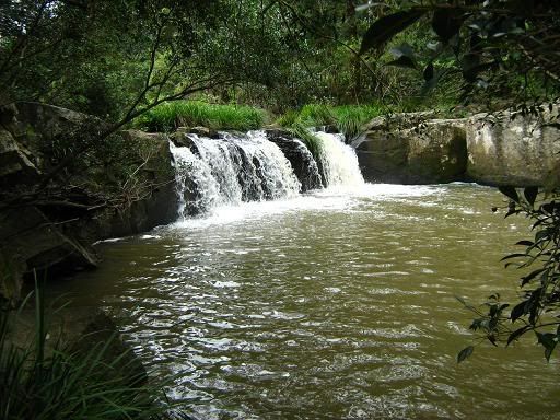
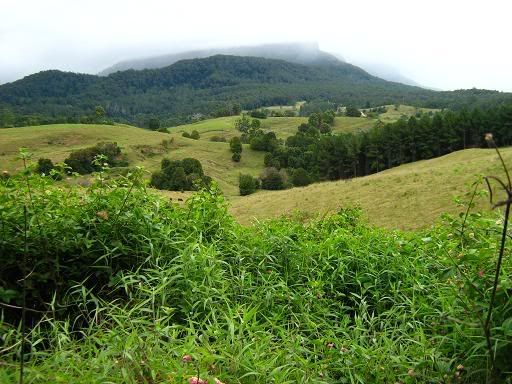
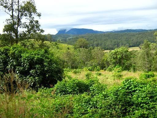
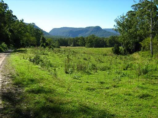
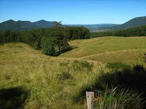
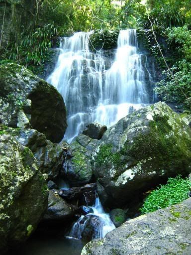
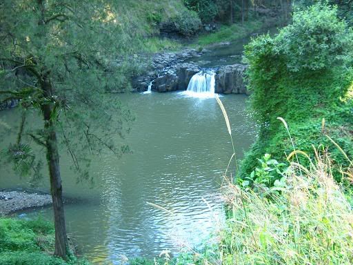
If you're looking for non-St. Peter related points of interest, there really aren't many that come to mind. The wetlands mentioned on the map weren't really prominent when I biked the loop, though that might have been due some exceptionally-dry weather at the time.
One thing that's pretty easy to find outside of St. Peter is the Kasota Stone Quarry. It's located right off the route and can be seen clearly from the road. While walking through a quarry full of bulldozers might be a little dangerous (at least it seemed like it to me), it is pretty cool to see the stone that was used to help build Target Field.
Possible ways to expand the loop: The easiest one I can think of is to keep heading west on Highway 99 into Nicollet. If your appetite is back by then, you can swing over to Schmidt's Meat Market and grab some beef sticks. If you want to loop back into Mankato from there, bike across Highway 14, hang a left onto County Road 25 and follow the back roads until you get to Lookout Drive. If you feel like getting a few golf swings in, the Northern Links is right on the way (though I'd recommend renting clubs, they might be tough to haul on a bike).

Monday, June 15, 2009

Snow time...

Quite a bit of snow has fallen over the past week leaving plenty at Paradise (a solid 2 feet). As you can see in this John Piastuck image, skiers and boarders (32 ants by my count) are "chomping at the bit" to climb Panorama Point for early season turns... This is looking to be a very promising ski season folks. The question is, will it hold; will it continue?
The Washington State Climatologists have something to say about our weather. They just published an
interesting report about our 2007 summer temperatures. It points to data that says we're still experiencing a warmer than normal trend (0.01 to be exact for Aug). I also found that they are willing to post an "Outlook" for the fall and winter. Check it out, but don't look for any clarity as it doesn't really predict anything substantial or exciting: "The Climate Prediction Center's 3-month outlook for November-December-January is for equal chances of above, below, or normal temperatures for Washington..."
Whatever the case, we're off to good start and the ants on Pan Point are seemingly stoked. With them are a few climbers who are hoping to find the summit this week. Perhaps they'll successfully weave through the upper mountain crevasses and visit Columbia Crest during this weather window.

If you are planning to climb this fall, here are few safety, registration and camping tips:
  • Expect crevasses: Though it's been snowing quite a bit this Sept/Oct, be prepared for lightly covered crevasses on the mountain.
  • Avalanche: Yes, slides have killed climbers in the fall on Mount Rainier and it could easily happen again. It doesn't take much to knock a team into a terrain trap (crevasse, cliff, hole) or bury someone. This is especially the case if the wind is blowing which could contribute to large snow deposits.
  • Poor weather: Ok, this is a constant on Rainier, but fall is definitely the time when storms linger longer than expected and climbers regret their "fast and light" plans. Be prepared to sit out inclement weather and expect heavy wet snow.
You can register in Longmire at the museum, or self register (i.e. honor system) at Paradise on the front porch of the Jackson Visitor Center. Most teams will select the Camp Muir Public Shelter for high camp accommodations. Over the past few years, that hut has been very accessible... But you should still bring a shovel to dig out the door and always clean up after you leave. On nice/busy weekends, bring your ear plugs (snoring, running stoves, chatter) and expect to breath stove exhaust in the hut.

Sunday, June 14, 2009

Mission Hibiscus


Mission Hibiscus, originally uploaded by ParsecTraveller.

Autumn may officially be here, but the hibiscus plants in central California don't know that. These hibiscus flowers were outside of the old mission in San Luis Obispo. Over by the veterans hall there are hibiscus bushes about 10 feet wide and at least five feet tall...giant.

Friday, June 12, 2009

Echo Wall first ascent

The final hard move on Echo Wall, Ben Nevis. This is a video still shot by Claire.
On Monday night (July 28th) I led my Echo Wall project. I was for me a perfect climbing day. Folk always ask me how doing a degree in sport science helped me do hard routes, expecting to hear about little details about physical training practice. But the biggest thing I learned was about how disparate the ingredients of a good performance are and how big an effect it has on the rare occasions when they come together at just the right moment. Monday was one of those days for me.
Throughout the spring and early summer, I pounded myself with training to reach a higher base level in my all-round strength and fitness. Once I started tapering in early July, I felt that strength come through. But my body was heavy from putting on a little too much muscle. 3 pounds taken off with a little diet in America (despite the lovely pancakes!) slotted in another piece of the puzzle.
Racking up for the lead, looking pale. Video still: Claire MacLeod
The break from the route in the US brought back the freshness and the fire to be back at the wall spending more time in those beautiful surroundings and reminded me just how badly I wanted to climb this piece of rock. But it also took the edge off my fitness.
Two hard days on the wall immediately off the plane with two gentle rest days afterwards put me in really good physical shape. Then, Kev Shields, a man who ‘knows the score’ when it comes to bold routes and a good person to be around on a scary lead day, was up for a look at some other unclimbed rock beside my project. A day’s worth of clear air broke the cycle of humidity of late, so we walked in on a relaxed morning.
At the shakeout before the most serious part of the climb. Video Still: Claire MacLeod
The air was so crisp but it was hot. Kev checked out a big groove, I belayed, time passed. I was waiting for the Katabatic winds of the late evening rolling off the plateau and snowfields just above the route. At 8pm the chill wind gently got going. I waited and waited until the temperature and rock friction was perfect, and at 9pm exactly, all this preparation over months crystallised and I led the route in a dream state of confident execution.
It felt easy, as every hard route I’ve ever done has – the great paradox!
Echo Wall, I am just pulling over the roof, low on the arête. Video still: Claire MacLeod
As I hoped, my feeling at the start was not “how can I dare to lead this route?”, but “how can I dare not to lead this route?” What an opportunity! All these ingredients coming together to put such a fine climbing experience on a plate in front of me.
There was the question of the last boulder problem. I had fallen there sometimes on the toprope. To fall here on the lead is to leave yourself with only an RP in a finger width flake of suspect rock, with a skyhook stacked on top of the RP as the last barrier between you and a 20 metre fall to the floor.
The only chance of falling would be to continue above the roof knowing you were too tired due to poor conditions or errors. A clear judgement to jump off before it got too late and you got out of range of the gear. I would have done this if I needed to.
I felt that the biggest risk of all would be to stand at the foot of such a great and memorable route (experience) and back out due to fear of injury. My fear of lost opportunity is greater, attraction to the positive experience on offer greater still.
Claire a tiny dot in Observatory Gully, left of the snow.
The feeling of climbing the moves on perfect rock, in perfect conditions in the company of Claire and Kev will stay with me all my life for sure. It’s hard for me to describe the feeling of freedom from experiencing that something that had seemed so unreachable could feel so effortless, all that was required was to draw the right ingredients together, piece by piece over time.
My strongest image from the day though was of Claire as Kev and I arrived at the top of the wall, high on Tower Ridge, looking down on Claire – a tiny dot climbing the endless nightmare of scree (Observatory Gully) yet again. Although my name only is on the route description, it was a team ascent.
There are so many things to talk about – Ben Nevis climbing, what to do now, more about the climbing on Echo Wall… But that will do for now. Thanks for all your messages you sent me about this over the past months I really appreciate it! There are more video stills from the route and thoughts from Claire on her blog.
Claire looking remarkably happy to be on the Ben after midnight!
Route description:
Ben Nevis, east aspect of Tower Ridge, about 1100m alt.
Echo Wall **** 100m Dave MacLeod July 28th
Grade: Harder than Rhapsody (or anything else I’ve been on)
A spectacular route taking the huge sharp arête of Echo Wall, well seen from Tower Ridge or when ascending Observatory Gully. Poorly protected in general with groundfall potential at 20 metres near the end of the crux section.
1. 30m Climb easy slabs to a belay at the foot of the grossly overhanging arête of the buttress.
2. 70m Pull into an overhung groove and exit this with immediate difficulty. A hard and poorly protected boulder problem leads to the roof and an upside down rest. (wires, poor camalot 6). Pull leftwards over the roof with desperate climbing up the wall just right of the arête to a shakeout (RP & Skyhook in suspect rock). Move left to the arête and make very serious moves up this to a good spike and reasonable gear. Continue with more ease up the arête (runout) to a small ledge (drop your left hand rope to relieve drag). Continue up steep flakes in a great position to gain easy ground and a short solo to reach Tower Ridge.
Looking west from Ben Nevis at the end of a long and perfect day's climbing.

Sunday, June 7, 2009

Border Ranging


Mt Warning and the Tweed Valley from The Pinnacle
It was only on a spur of the moment that I opted for this tour, the plan was to delay the proposed Crows Nest tour by a week. As it turned out, the Crows Nest tour had to be cancelled (yet again) because of mechanical problems with my bike. I'll make it happen eventually. That wasn't going to stop me completing this ride last weekend, however. I had varying options for travelling over the familiar terrain this side of Murwillumbah, so I opted for the early climb over Tomewin to start the day. I had the company of a local rider I met at the bottom of the climb, and plenty of time to talk touring. I received another recommendation on North Queensland (among other things). I must give that some serious thought.
Tweed Valley waterfall
The Tweed Valley opened up after the climb, I parted with my companion at Murwillumbah, and continued south-west, through the lush greenery of the valley, onward toward Kyogle. This is a very pretty ride, but one that I've completed a few times from the other direction in completing tours. Yet it's one that I never tire of. I watched a rain shower move across Mt Burrell and the Border Ranges National Park after lunch, and started the climb of the Nightcap Range.

The temperature cooled at the top of the range as the rain arrived. It was light rain, and not enough to make me bother with a jacket, but I did appreciate the drop in temperature. A new backpackers' has opened at Wadeville, behind the local store (Wadeville Woolies). I considered taking a campsite here, but opted against it on the grounds that Kyogle was a better base for attacking the Border Ranges climb from the west.
the view toward Mt Burrell
A leech dropped from a tree, but was displaced before it had time to take a bite. Further on I descended into Cawongla, and slogged up the 11% rise out of the village onto the Mackellar Range. It had been over 12 months since I last noted this particular climb, and the gradient took some adjustment. In time it was conquered, and followed by a lazy descent into Kyogle. Here there is a plaque for Ray Smith, commemorated at a local lookout. It seems Ray Smith's only notable claim to fame was that in 1968 he was "accidentally killed". More information would have been nice, but the plaque disclosed nothing else.
Ray Smith lookout, Kyogle
A miracle happened in Kyogle. For the first time ever (as far as I can recall), the local supermarket was actually open. It has been closed every other time I've been in town, and I was beginning to wonder if it had opening hours at all. Although it was still fairly early in the afternoon, already the conversations between drunks in Kyogle were almost entirely composed with four-letter words. I thought it better to retire to my local campground on the northern edge of town where travellers might provide some more intelligent and enlightening conversation.
* * * * * * * *

This was the day of the return to the Border Ranges National Park. It would see a climb of some 1,100 metres, some beautiful rainforests, and a lot of dirt. I rode the first 15km or so out of Kyogle without any excitement. The temperature was warming quickly, but I was planning on picking up some altitude quickly and making this irrelevant. A couple of South Africans on a motorbike asked for directions back to the Gold Coast, then took the long way over the range in any case. At least they didn't stop and argue for an hour the way local bogans do here on the GC.
I had this view from a plateau around 400 metres above sea level, the climb was still to come
The road turned to dirt, then to mud as the climb kicked in, with one particularly steep section (17%) by a quarry before I entered the National Park. I saw a sign pointing to a side road back to the Lions Tourist Road, and wondered if the South Africans would take the really long way home. The climb kicked up to around 7% -- not normally a problem, but the muddy track presented some difficulties. This was where those long rides with Martin made the difference. I reached a creek crossing after a sharp descent, and headed off on foot in search of Selva Falls.
Ahhh!
The beautiful Selva Falls
My bushwalking skills had improved immensely since my last visit to this region in 2001, and the track was negotiated easily despite the wet, slippery conditions. I seemed to outrun the leeches too. I think experiences like this are what living is all about, a beautiful rainforest setting, a rough, overgrown walking track that requires intense concentration, a combination of factors that leave many of the things in the "real world" behind. Yet for all that, there are still people who stay in the carpark without doing the walk. Incredible!
Lost world
Now it was time to get back on the bike and return to climbing. I had descended to around 720 metres for this walk, so I had to climb again, up to the northern end of the park, and the Lost World wilderness. This area shares a boundary with Lamington National Park immediately on the other side of the Queensland border, and there is, by all accounts, a rough walking track linking the two. Now that would be an adventure. Yet the view "over" the Lost World is strangely disappointing, almost as if it fails to do justice to the spectacular, wild areas that surely lie within.
Tweed Valley Lookout, clearly showing the pinnacle attached
And so I continued, over rolling hills on the dirt road toward the eastern side of the escarpment. I now felt gratitude that I had a lighting system capable of finishing this ride in darkness should it be required -- I wanted time to really enjoy this one. There seemed to be a strange scent to the forest here, it reminded me of some of the moisturisers I've used to relieve sunburn after rides past. Perhaps some of their ingredients are sourced from rainforests, I'll never know. The Tweed Valley lookout proved that the "pinnacle" was, in fact, attached to the plateau. An optical illusion on a previous Tweed Valley ride had suggested this wasn't the case.
The Pinnacle lookout
After proving that the "pinnacle" (around 200 metres lower than the mountain's highest point), I was now under a moral obligation to climb it and take in the view. It was, indeed, spectacular, as were all the other views from this side of the escarpment, stretching for hundreds of kilometres. It really is a great way to get a different perspective of some of the areas I regularly travel that give me so much pleasure. And yet, even now, this day wasn't finished.

My legs had some complaints about the final climb to The Bar Mountain over the mud, which was still rather slippery, but the scenery provided plenty of inspiration, and left plenty of oxygen in the air. The Bar Mountain itself ultimately proved a disappointment. Walking tracks branched off from a picnic ground here, but I could find no mention of the Collins Creek Falls that I'd read about elsewhere. That will have to wait for another day, but there was still one final twist in this tale. If the local graffiti "artist" at the picnic ground ever reads this, s/he would be advised to learn how to spell the words before trying to write them -- what exactly are "hippeys"?
Hanging Rock creek falls
I descended, nay, plummeted down the mountain at a gradient-inspired speed that really was much too fast, losing a pair of sunglasses in the process, but somehow surviving, then I completely ignored the signs directing me to Kyogle and headed off down another route. If a map I had seen at the Sphinx Rock cafe the previous day was correct, I could find another waterfall. It all fell into place beautifully, and after a beautiful, deserted ride by a creek, I discovered an unsigned waterfall, small but pretty and totally uncluttered. It provided a great finish to a memorable day.
I returned to the main road near Cawongla, rode over that 11% climb again, and returned to Kyogle with over 2,200 metres of climbing in around 104km. It was a taxing but extremely rewarding day, and one that I may yet make an annual fixture on my calendar. Northern NSW truly offers some of the best cycling in Australia. Incidentally, that takeaway joint in Kyogle's main street that advertises pasta doesn't actually sell it. Given that it's been about two years since they last did, they should probably consider removing the sign.
* * * * * * * *
Mt Burrell and The Sphinx
Now all that was left was the final ride back to the Gold Coast to complete the weekend. I've done this many times over, and yet those two initial climbs out of Kyogle remain a challenge. Either that, or the previous day's ride took more out of me than I was prepared to admit. I got over the climbs and descended my way into the Tweed Valley, before negotiating the rolling hills toward Murwillumbah.

There are all sorts of little surprises in the Tweed Valley, and not all of them are natural features. A rather large property near Uki had a big "No Nightcap Dam" sign at their front gate, and a tee-pee in their back yard. There was quite a pile of other stuff there too, including a couple of caravans and various junk accumulated over an apparently long time. A couple of motorbike riders wanted to have a chat as I rode along. It was nice to have a chat, but it's hard to speak at a volume loud enough to drown out their motor and save enough breath to keep pedalling. Maybe next time I'll pull over.

After Uki the northerly wind picked up, which increased the temperature and slowed my progress. Fortunately, I had the option of returning home via Urliup, which threaded a needle through more rainforest and eliminated both the heat and the rainforest. After negotiating Bilambil and the last 25km of suburbia, it was done. Another memorable cycling weekend was completed. As noted before, this weekend's Crows Nest tour is delayed, probably until next month now, but there will be other fish to fry in coming weekends. I also have a 400k to prepare for, probably on the weekend following the Crows Nest tour (assuming it goes ahead this time). Bring it on.

Wednesday, June 3, 2009

Happy New Year


This was the image on my sister's Christmas card this year, but I think he makes a good New Year's Koi too, don't you? (It seems like he's swimming in confetti.)
I was impressed that my 4th grade niece had colored such a pretty carp. Then I found out that she'd actually drawn it! She said they'd had something to copy from, but it isn't traced.
I think we've got a budding artist in the family.

Monday, June 1, 2009

Garden Nostalgia- Fernleaf Peony

When a fragrant white ginger or a loquat tree or the Little Gem magnolia is in bloom, being in Austin seems to have advantages over colder places ... but when Dee of Red Dirt Ramblings put up last year's peony pictures, it makes me feel as if we Zone 8 folks have the short end of the stick! Ah, Peonies!
Annieinaustin,Fernleaf peony
Dee talked about the possibility of peonies living longer than their owners, and she also mentioned ordering her peonies from Klehm's Song Sparrow Nursery. That made me remember a plant given to me by a long-ago neighbor. Lee said that her lovely Paeonia tenuifolia came from the personal collection of a Klehm family member decades before we met. One autumn she split off a small piece and shared her Passalong peony with me. It grew for a few years before showing the first flower and by 1996 made the May bouquet in the old photo. I knew that trying to bring it here was equivalent to murder so regretfully left it behind. In my mind the fernleaf peony is still there, and still blooming every May.